“The Big U” protect Lower Manhattan from sea level rising damage
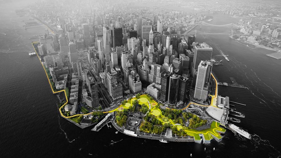
The Big U is a protective system around Manhattan, driven by the needs and concerns of its communities. Stretching from West 57th street south to The Battery and up to East 42th street, the Big U protects 10 continuous miles of low-lying geography that comprise an incredibly dense, vibrant, and vulnerable urban area. The proposed system not only shields the city against floods and stormwater; it provides social and environmental benefits to the community, and an improved public realm.
The proposal consists of separate but coordinated plans for three contiguous regions of the waterfront and associated communities, regions dubbed compartments. Each compartment comprises a physically separate flood-protection zone, isolated from flooding in the other zones, but each equally a field for integrated social and community planning. The compartments work in concert to protect and enhance the city, but each compartment’s proposal is designed to stand on its own. Each compartment was designed in close consultation with the associated communities and many local, municipal, state and federal stakeholders; each has a benefit-cost ratio greater than one; and each is flexible, easily phasable, and can be integrated with in-progress developments along the City’s waterfront.
The proposal consists of separate but coordinated plans for three contiguous regions of the waterfront and associated communities, regions dubbed compartments. Each compartment comprises a physically separate flood-protection zone, isolated from flooding in the other zones, but each equally a field for integrated social and community planning. The compartments work in concert to protect and enhance the city, but each compartment’s proposal is designed to stand on its own. Each compartment was designed in close consultation with the associated communities and many local, municipal, state and federal stakeholders; each has a benefit-cost ratio greater than one; and each is flexible, easily phasable, and can be integrated with in-progress developments along the City’s waterfront.
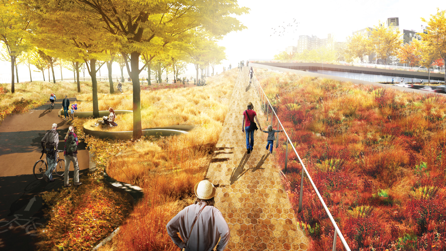
Bridging Berm provides robust vertical protection for the Lower East Side from future storm surge and rising sea levels. The Berm also offers pleasant, accessible routes into the park, with many unprogrammed spots for resting, socializing, and enjoying views of the park and river. Both berms and bridges are wide and planted with a diverse selection of salt tolerant trees, shrubs and perennials, providing a resilient urban habitat.

Between the Manhattan Bridge and Montgomery Street, deployable walls are attached to the underside of the FDR Drive, ready to flip down to prepare for flood events.
