Risk Assessment for Mokpo
scientists predict that Mokpo will have 40% if it’s city under serious threat if the sea level was to rise by over 1 metre in the next 80 years.
So planning authorities in Mokpo undertook broad analysis on how they could adapt their coastal planning strategies to mitigate the effect of the rising sea level threat
Mokpo city identified 3 areas within their city that would be nominated as areas of high risk to effects of future rising sea levels. Consideration was given to the inundation potential of the area, current flood plans ,topography ,land uses and development potential
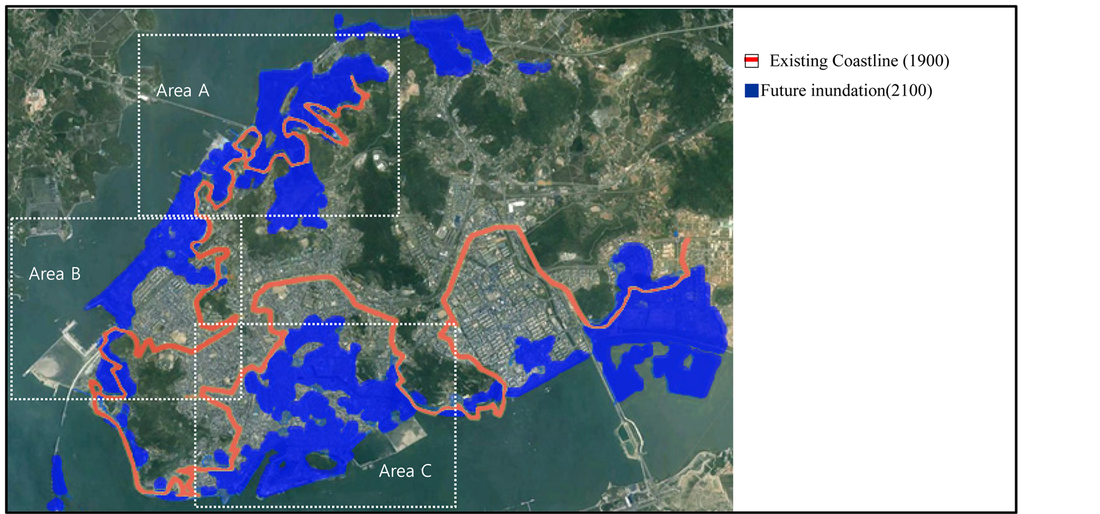
Area A- The Northern CoastlineThis area was identified as an undeveloped area of coastal swamps that had been ear marked for landfill reclamation and the future development of industrial complexes.
Area B- The North PortThis area was identified as another reclaimed area currently utilized as a commercial hub for the city with a 20 m set back from the coastline that accommodation recreation space as well as the seafood markets and maritime services. Whilst there is current agro industrial development taking place to reinforce the current drainage system, it has been noted that this will not be sufficient to cope with the future sea level rise
Area C:This Area has the largest portion of potential exposure to flood inundation. The area has been reclaimed for use as the cities port facilities and the community water transport hubb. It also incorporates low density housing of 1-2 levels and higher density accommodation of mid rise apartment buildings. This area is potentially at the highest risk as it is envisaged the water will flood the shores approximately 3kms back into the residential area.
|
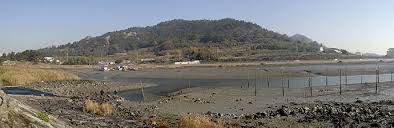
Coastal swamp area of Mokpo (2011)

Foreign Affairs Office Of Xiamen. 2015 , Mokpo city Viewed 29 August 2015
|
|
|
